
- Water bodies across the Brazilian state of Roraima have shrunk in area by half over the past 20 years, according to research from the mapping collective MapBiomas.
- Today, locals are facing even drier times amid a severe drought in the Amazon, which has led to record-low levels of water in the rainforest’s main rivers.
- Since 1985, Roraima’s agricultural area has grown by more than 1,100%, with experts pointing to crops as one of the state’s main drivers of water loss.
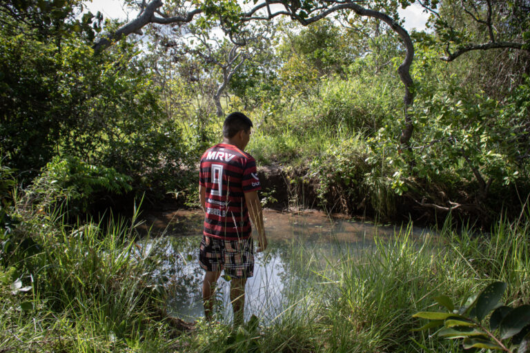
MORCEGO, Brazil — During the rainy season, the sunlight that passes through the leaves of the mirixi and jenipapo trees paints golden patterns in the blue-green water of the creek that runs through the Morcego Indigenous community.
“This is where my younger brother learned how to swim as a kid,” Leirejane Nagelo, the tuxaua, or chief, of the community, tells Mongabay. Back then, the creek’s level was high enough. Nowadays, however, if her 25-year-old brother, Daniel Nagelo, were to step into the water, it would barely reach his waist — even during the wet season here in the Amazon.
Morcego Creek, named after the community, runs behind Leirejane’s house, where she lives with her husband and six children, all under the age of 16. It’s concealed beneath the shade of bushes on a 100-meter (330-foot) walk under mango trees and over a tall grass field.
Morcego is one of the three communities located inside the Serra da Moça Indigenous Territory, in the Brazilian state of Roraima, and its creek is the only natural water source in the 11,417-hectare (28,212-acre) territory. Officially protected by presidential decree in 1991, Serra da Moça is home to nearly 750 people, according to a 2022 census.
Like most Indigenous lands in the state, Serra da Moça had its boundaries demarcated in what’s known as an island format. Rather than being composed of a large, contiguous swath of territory, it’s small and encompasses only a few communities, separated from one another and surrounded by monoculture plantations.