arrow-up151external-linkPainRNAi [he/him] to traingang • 2 years agomessage-square22 Commentsfedilink
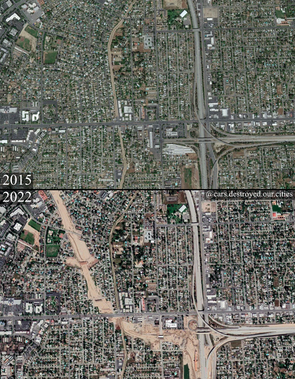
minus-squareTyMan210 [he/him, comrade/them]hexbear15·2 years agoAs far as I understand it, the top half is just the satellite view of a neighborhood from 2015, and the bottom half is that same neighborhood in 2022 with a swath cut through it for a highway to be built link

As far as I understand it, the top half is just the satellite view of a neighborhood from 2015, and the bottom half is that same neighborhood in 2022 with a swath cut through it for a highway to be built