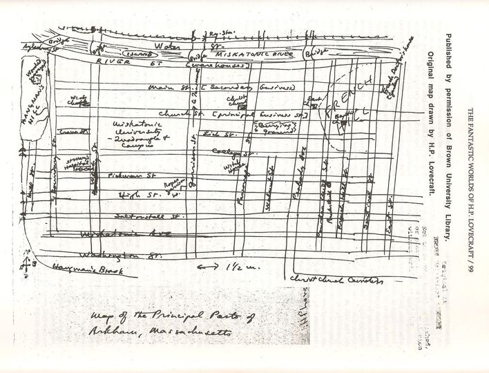
The grid over the hill in the east as if it’s not there would probably make for steep streets that are a pain to walk up. But the hill in the west appears to use a more flexible plan that takes the shape of the terrain into account. The differing block sizes is also quite suggestive. From these details we can conclude that the wider blocked streets in the west with the easier to traverse layout probably has much larger property boundaries and is the wealthy part of town. The smaller blocks with smaller lots and the difficult to walk grid in the east would be the poorer part of town.
A few decades after this drawing was made, the east end would have had a highway bulldozed through it. The west side of town will move to the suburbs. A couple more decades after that, the north side of the river with the train tracks and probably various warehouses and such would be deindustrialized, further plunging the town into desperate poverty. Another decade after that, the west side would begin the process of gentrification by becoming a funky arts district. This gentrification would continue north of the river as the poorly maintained train tracks get dug up and replaced with a walking path.