

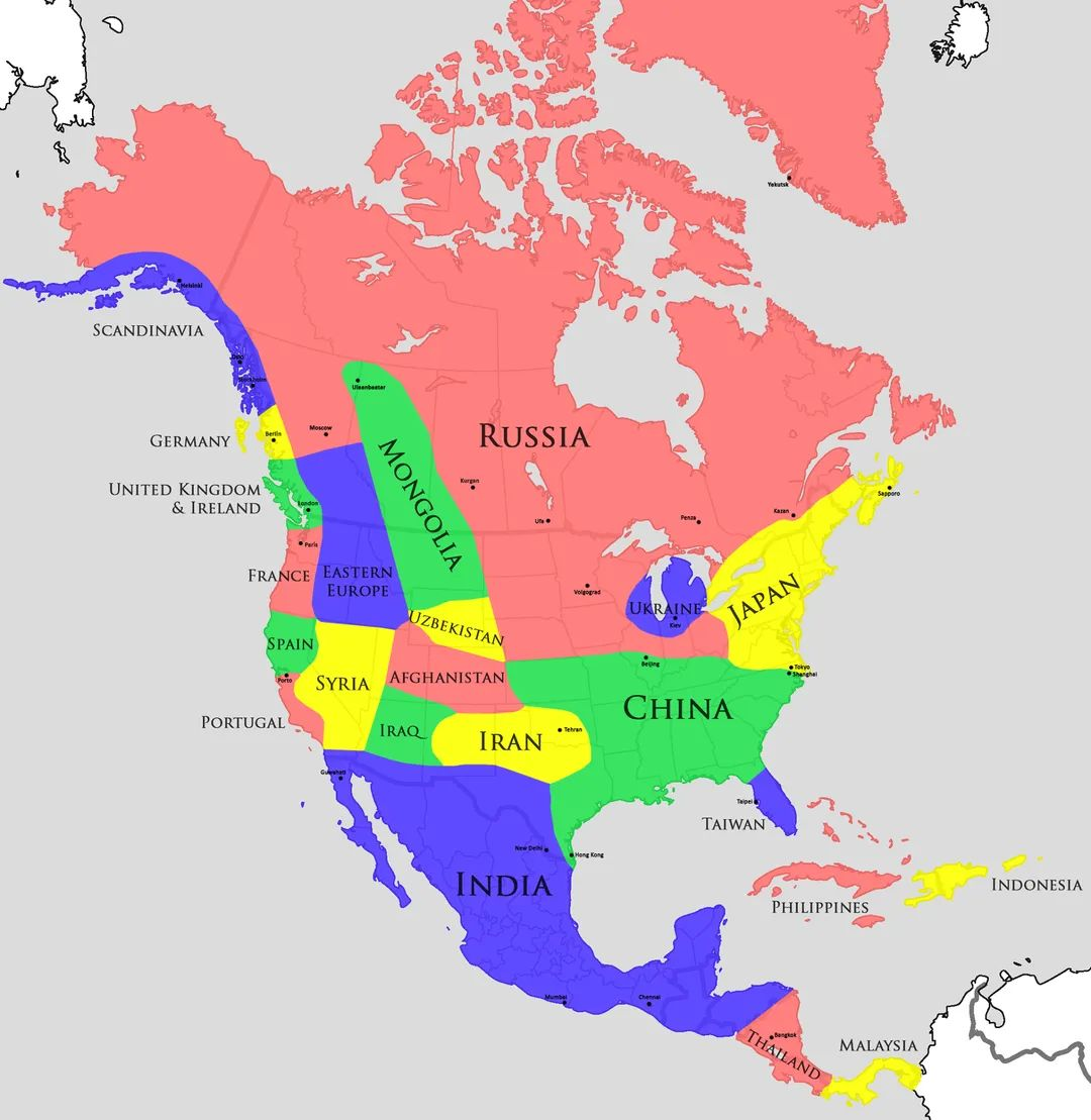
Kinda wish it also had provinces of the nations shown so we can get more accurate pictures of how it feels in other countries. I appreciate including cities though, that's a nice touch.
Kinda wish it also had provinces of the nations shown so we can get more accurate pictures of how it feels in other countries. I appreciate including cities though, that's a nice touch.
Korengal Valley reminds me a lot of Northern Colorado, where it's still arid but you're starting to get more northern precipitation so things are green but there are cacti in the conifer forests:
Korengal - https://static.planetminecraft.com/files/resource_media/screenshot/1215/Bibiyal_Ali_Abad2C_Korengal_Valley2C_Kunar_Province2C_Afghanistan_1929288.jpg
Poudre Canyon, an hour north of Denver - https://followbillandcarol.files.wordpress.com/2020/10/20200618_124040ed.gif?w=800
The Himalayas are too vertical for us. We have a lot of Nepali/Tibetan/Indian immigrants from the Himalayas because it's the closest thing they can find to that, but Lhasa is at 3490m in elevation and that's the summits above our ski towns.
Yeah I meant relatively--Colorado is the highest expansive zone of the US. Technically you could argue New Mexico/Utah/Wyo as well, but Colorado is the source of the most important river in the US West, ergo it is the "Tibet" of the US
In absolute terms Colorado is 11,000ft mountains surrounded by a 5,000ft plain, which is mostly blonde but still somewhat green
Meanwhile Afghanistan (as a whole) ain't got no melanin in that soil. The Korangal valley does but I still think a better comparison for Colorado would be Qinghai or Gansu
also found a great photo from your link: https://en.wikipedia.org/wiki/Kunar_Province#/media/File:US_soldiers_with_cows_in_Kunar_Province_of_Afghanistan.jpg